How the Earth's magnetic field could help navigate when there's no GPS
Leidos is developing quantum navigation, which uses natural geomagnetic signals that resist jamming and spoofing, for defense applications
Three points to remember
- The Defense Innovation Unit has selected Leidos to help prototype and field-test a quantum sensing technology that could potentially be used on planes and vessels for determining position, navigation and timing.
- Leidos, working with subcontractor Frequency Electronics Inc. and partner MIT Lincoln Laboratory, is using engineered diamond crystals whose quantum behaviors are sensitive to geomagnetic changes.
- Sensors outfitted with these "nitrogen-vacancy diamonds" can help identify a plane or ship's location plus determine its direction and speed by detecting unique magnetic anomalies across the Earth.

The Global Positioning System, or GPS, underpins how most of the world knows where they are and where they’re heading. Cars, aircraft, ships, autonomous systems and phones rely on its satellite signals, but GPS can be blocked or spoofed, especially during conflicts.
The Defense Innovation Unit (DIU) has thus embarked on prototyping and field-testing quantum sensing as another means of military navigation in GPS-denied situations. Leidos, selected for DIU's Transition of Quantum Sensing (TQS) program, is developing a sensor that uses the Earth’s magnetic field and naturally occurring quantum phenomena to help planes and vessels determine positioning, movement and timing.
“The appeal of magnetic navigation, beyond its resistance to jamming, is that the Earth’s magnetic signals are everywhere and always there — day, night, over land, over water and no matter what the weather is,” said Doug Stranghoener, geophysical navigation department manager at Leidos. “GPS works great, but it’s not always available and you can’t always depend on it.”
Navigating with magnetometers
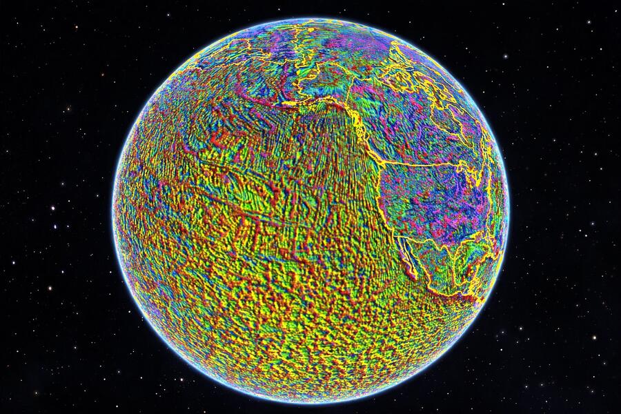
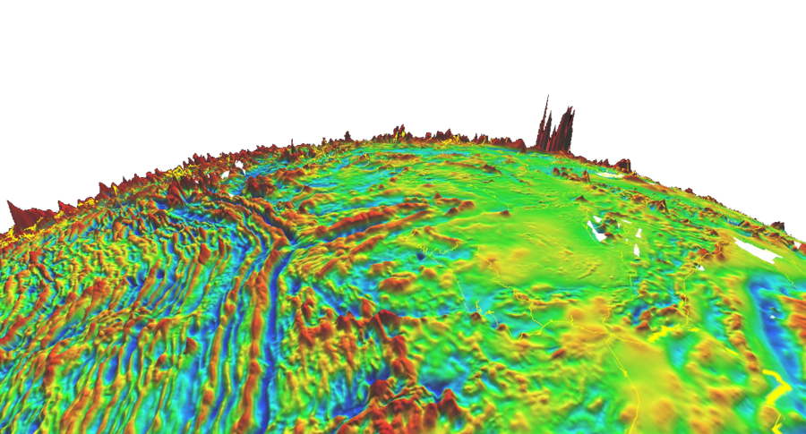
In contrast with manmade signals, the geomagnetic field produces natural and constant signals that are fundamentally immune to manipulation. From this field, magnetometers can sense small and unique disturbances caused by local variations in the Earth’s crust.
Maps have been produced by surveying these magnetic anomalies across the globe. Magnetic navigation, or MagNav, works by matching these “fingerprints” to what magnetometers pick up. It’s like comparing landmarks you see to mapped references during travel but with magnetic signatures instead.
“If a certain location on the Earth has a lot more iron — and with iron being magnetic — it will alter the magnetic field,” Stranghoener explained. “This crustal makeup is generally stable over geological timescales.”
This means that, although the total geomagnetic field is actively in flux, the crustal anomaly signals remain relatively unchanged for MagNav to work. Governments, non-governmental organizations and industry are working on various efforts to develop high-fidelity maps of these signals that could be used to improve MagNav accuracy.

The appeal of magnetic navigation, beyond its resistance to jamming, is that the signals are everywhere and always there. Also, with MagNav, I’m not worried about weather or clouds. So there’s a lot of interest in quantum sensors.
Doug Stranghoener
Leidos Geophysical Navigation Department Manager
A diamond (magnetometer) is forever
Because this field is generally weak, it’s critical for magnetometers to maintain high sensitivity, large detection range and low drift. This is where quantum magnetometers, possessing time-stable and atomic-scale sensitivity, have a critical advantage over their classical counterparts, such as fluxgate sensors that can lose long-term performance due to temperature and mechanical factors.
As part of DIU’s TQS program, Leidos is developing a prototype quantum magnetometer that uses engineered diamond crystals with an atomic defect known as a nitrogen-vacancy (NV) center. The synthetically created defect produces quantum behaviors that are highly sensitive to tiny magnetic field changes.
While in motion, NV diamonds essentially become vector sensors, enabling measurement of latitude, longitude and altitude as well as magnitude (velocity) and thus detailed navigational information.
Intended to be fieldable next year, the NV-diamond sensor is being commercialized by Frequency Electronics Inc. under subcontract to Leidos and in collaboration with MIT Lincoln Laboratory, a federally funded R&D center. The main goal is to demonstrate viable, airborne MagNav with a quantum sensor inside an aircraft cabin, where there’s a lot of signal noise caused by electromagnetic interference from metal, high-current wiring and electronics.
“The sensor was originally developed by MIT Lincoln Lab, and Frequency Electronics is working on productizing it to a flight-ready package with associated electronics,” said Jordan Britt, guidance, navigation and control engineer at Leidos.
The project partners are working on reducing size, weight and power (SWaP) requirements to make the magnetometer operationally relevant. The Leidos team is also developing a set of software-based techniques and algorithms to help calibrate the sensor and filter out unnecessary components of received electromagnetic signals, as well as to cancel interference effects and other error sources.
“The biggest error you have to resolve is platform effects, so you have to go through a calibration process,” Stranghoener noted.
Sensor location on a platform, be it a plane or ship, can also help mitigate interference effects, and low SWaP provides greater placement flexibility, he added.
A complement, not a replacement
Quantum sensing is designed to be used in coordination with GPS or as a secondary system when satellite navigation is being affected or compromised. DIU noted that its goal is to field compact, cost-effective quantum sensors that provide warfighters robust and reliable navigation when they cannot rely solely on external reference signals like GPS.
Stranghoener sees quantum navigation being useful in operational scenarios where it can guide an aircraft or a vessel for the early to middle stages of travel before GPS or another system can take over for the final phases. Still, it can overcome limitations that can hinder other systems.
“There’s a host of alternative navigation systems,” he said. “They all have pros and cons, and many use vision-aiding — cameras that look down and use feature matching. If you’re over water, there’s nothing you can look at.”
He added: "Also, with MagNav, I’m not worried about weather or clouds. So there’s a lot of interest in quantum sensors.”